


Voting District 4, Chowan County, North Carolina
About
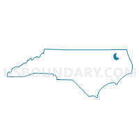
Outline

Summary
| Unique Area Identifier | 639682 |
| Name | Voting District 4 |
| County | Chowan County |
| State | North Carolina |
| Area (square miles) | 32.76 |
| Land Area (square miles) | 32.74 |
| Water Area (square miles) | 0.02 |
| % of Land Area | 99.93 |
| % of Water Area | 0.07 |
| Latitude of the Internal Point | 36.19934720 |
| Longtitude of the Internal Point | -76.60763170 |
Maps


Graphs
Select a template below for downloading or customizing gragh for Voting District 4, Chowan County, North Carolina


Neighbors
Neighoring Voting District (by Name) Neighboring Voting District on the Map
- Voting District 1, Chowan County, NC
- Voting District 2, Chowan County, NC
- Voting District 3, Chowan County, NC
- Voting District 5, Chowan County, NC
- Voting District BELVID, Perquimans County, NC
- Voting District WEST H, Perquimans County, NC
Top 10 Neighboring County Subdivision (by Population) Neighboring County Subdivision on the Map
- Township 1, Edenton, Chowan County, NC (7,731)
- Township 2, Middle, Chowan County, NC (3,644)
- Hertford township, Perquimans County, NC (2,601)
- Township 3, Upper, Chowan County, NC (1,333)
- Belvidere township, Perquimans County, NC (1,302)